There have been increasing exchanges of fire on Israel’s border with Lebanon, where Hezbollah has been firing at Israelis and Israel firing back. While several people have been killed on each side, it has not as of this writing broken out into a full war. That could change at any moment. If that happens, expect thousands of heavy and guilded missiles to be fired by Hezbollah at Israel, and heavy Israeli air and missile attacks on Hezbollah and the rest of Lebanon.
Expect also a land invasion by Hezbollah, which has been very openly touting its capabilities to grab and hold Israeli towns and territories. One such town which certainly will be attacked is Metula, which is a land peninsula surrounded on three sides by Lebanon.
In 2013, I visited Metula, and was given a tour (from the Israeli side of the border) of a fake village Hezbollah had constructed as a launching point to attack Israel. I’m re-running that post, so when you hear in the news about Metula, you will have a better understanding: Metula and the fake Hezbollah village.
——————–
The last in my series of posts from Israel:
After leaving the Valley of Tears battle monument, we descended from the Golan Heights towards Israel’s northernmost town, Metula.
But along the way, we stopped at the Druze town of Mas’ade for lunch at the Nedal Restaurant. Here’s the view towards Mount Hermon (lost then recaptured during the 1973 Yom Kippur War) from in front of the restaurant:
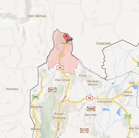
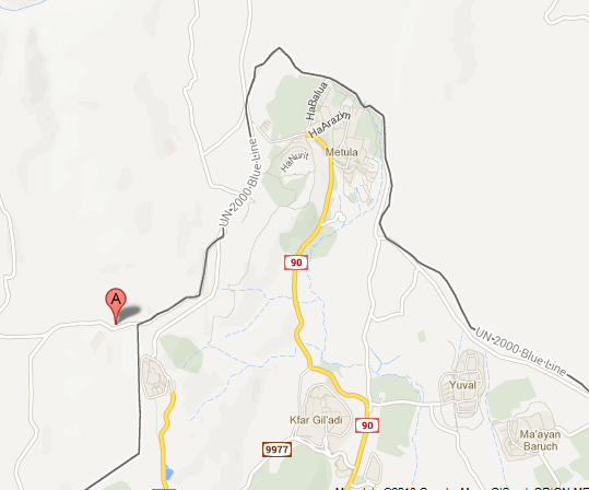
You can see on this map how far north Metula is:
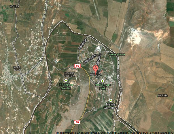
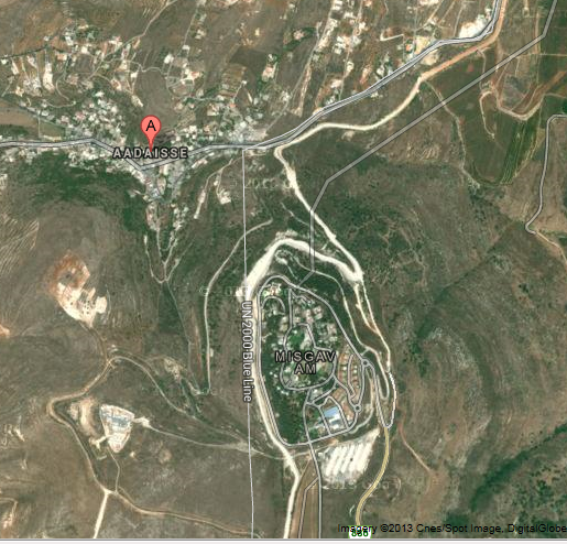
These map view give a good perspective on how Metula is surrounded on three sides by Lebanon:
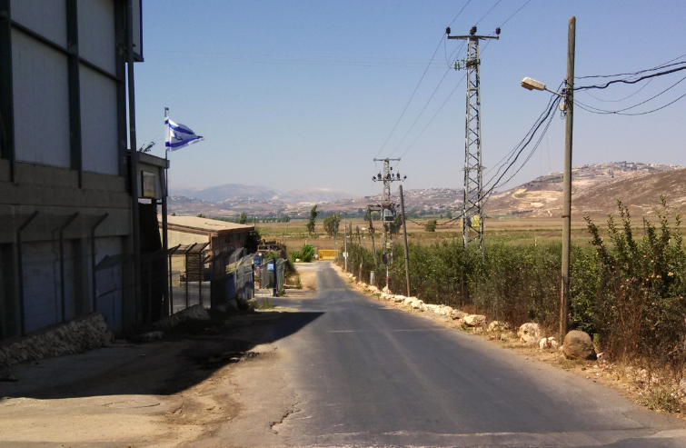
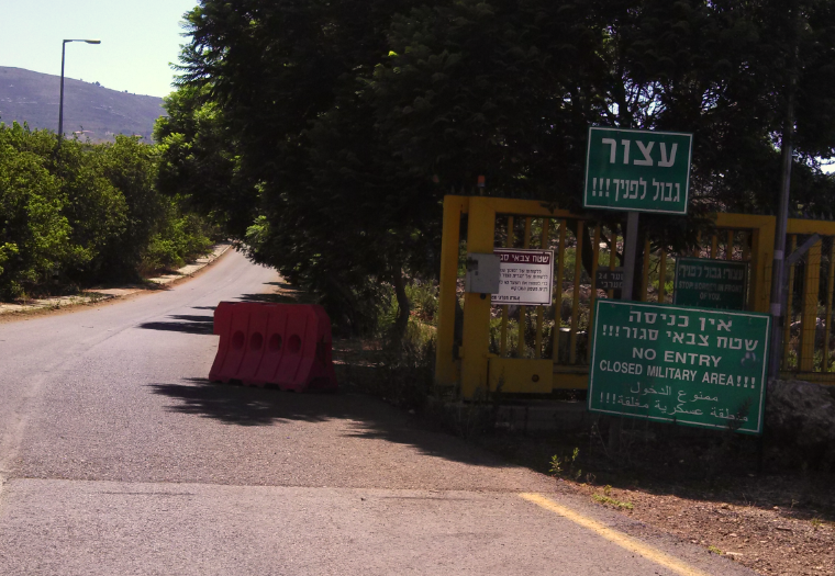
We were able to see the border fence from just about all vantage points. In this photo, the yellow gate is not the border fence, but controls access to some fields Israeli farmers use. The actual fence is just beyond:
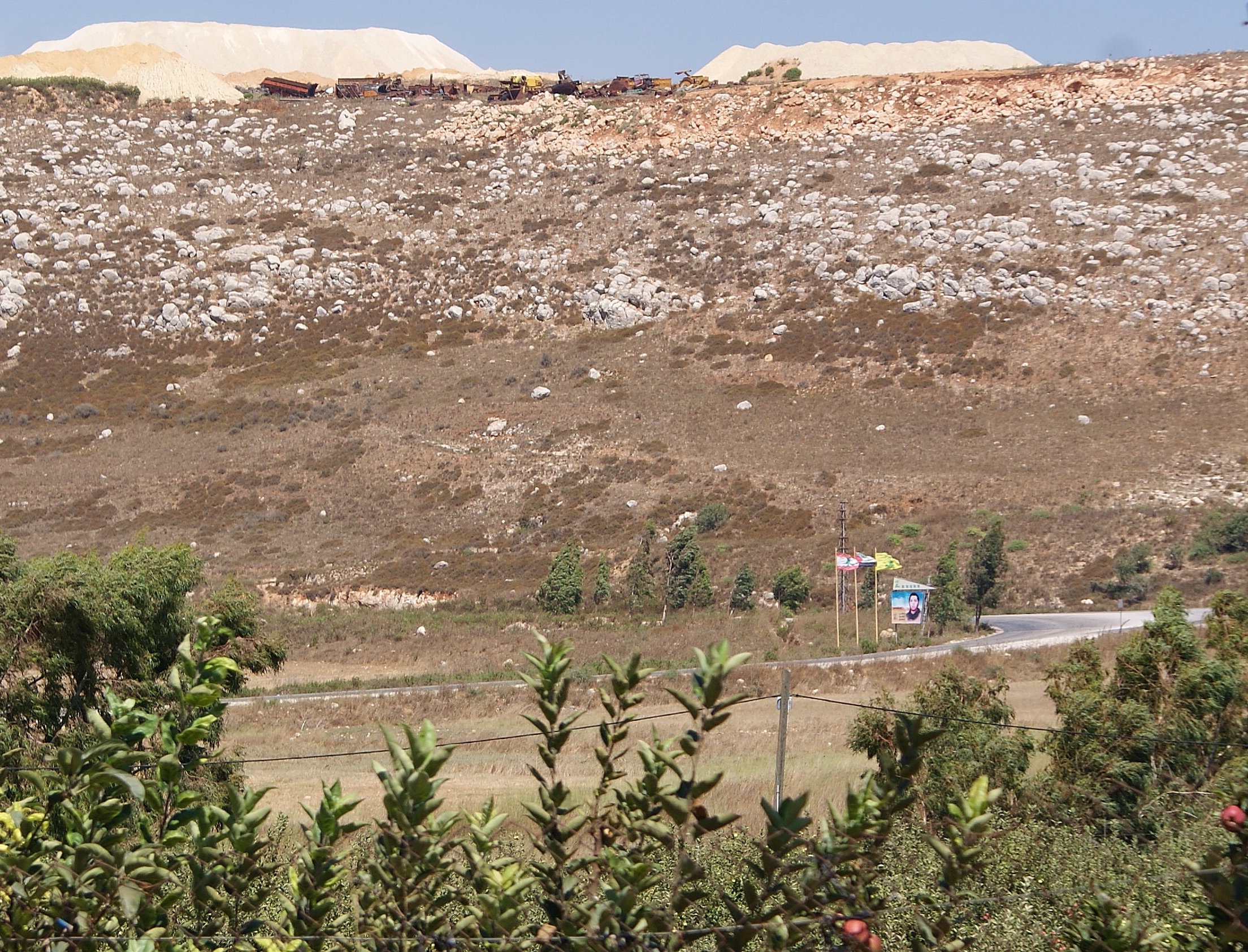
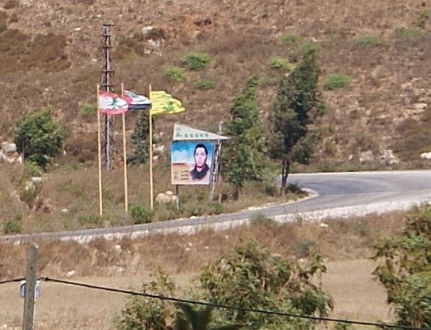
Here you can see a just-slightly zoomed image from the same locate looking just to the right, with the Lebanese, Palestinian and Hezbollah flags and a large billboard featuring an unkown person, with newly constructed Hezbollah earthen berms at the top of the hill. Hadar Sela, our “guide,” was able to capture the images better than I could:
Because of the history of Hezbollah kidnappings and shootings along the border, and because the border surrounds Metula on three sides, it’s not uncommon to run into signs like this, declaring the area a closed military zone:
When we drove to the Mitzpe Benia lookout point at Kibbutz Misgav Am just south of Metula. The area is heavily patrolled, and we were visited by Israeli soldiers in armored vehicles as we were returning to our car.
The Lebanese village of Aadaisse (various other spellings) to the left was the scene in 2010 of the sniper attack by the Lebanese Army on Israeli observers watching the removal of trees beyond the border fence but within the U.N. certified blue line delineating Israeli territory. One Israeli officer was killed.
Hadar asked if I noticed anything unusual about this border area of Aadaisse. I looked, but didn’t notice anything.
Then she pointed out that there were no windows on the houses and no sign of life (other than a single car we saw drive through at one point).
It has been suggested that this is a fake village (or at least, section of a village) constructed by Hezbollah right up to the border. If and when another conflict breaks out, the supposed village will provide Hezbollah not only with firing positions, but many good photo-ops for a gullible media — look, the Zionist entity drove the people out and blew out all the windows!
This would be consistent with what Hezbollah is doing throughout Southern Lebanon, turning villages and civilian homes into weapons depots and firing positions.
Afterwards we headed back up to the Golan Heights and visited an excavated third or fourth century synagogue near the former Syrian village of Umm el Kanatir. The site is being reconstructed with original stones, which were electronically tagged during the excavation. The site was just recently opened to the public, and is one of dozens of ancient synagogues found in the Golan Heights.
A fitting end to our trip to the Golan, and our trip to Israel.
The full series of posts from my trip to Israel:
CLICK HERE FOR FULL VERSION OF THIS STORY