Syrian TV analyst not an Obama fan
From Syrian television, translated by MEMRI, a bizarre anti-Obama screed. h/t Free Syria Media Hub First a couple of screen captures: And the video: ...
From Syrian television, translated by MEMRI, a bizarre anti-Obama screed. h/t Free Syria Media Hub First a couple of screen captures: And the video: ...
How convenient. How abusive of the memory of those who fell, a clear ploy to gain political advantage from the significance of that date. The vote will be on Cloture for the resolution, not the resolution itself. It's an even higher hurdle. https://twitter.com/NewsBreaker/status/377131043498639360 https://twitter.com/BrianFaughnan/status/377130883599577088 https://twitter.com/susanferrechio/status/377131547725295616 Update 8 p.m. -- Facing mounting...
The threat of possible military action, as attenuated as Congressional authorization now seems, has led to what may be the endgame. John Kerry floated the idea of Syria turning over its chemical weapons or else, the Russians seized on the idea, and Syria in principle has...
The notion that Assad is only Syria's problem ignores the history of the Iraq insurgency, Lebanese assassinations, and the global Iranian-Hezbollah war against Israel and the United States....
There are very good arguments against intervention in Syria, even if I disagree with the conclusions reached from those arguments. I haven't denigrated those who disagree, although I can't say the same is true in reverse. Unfortunately, regardless of how you come out on the issue,...
Having been mostly away from the internet these past two days, I've watched from afar how quickly things have turned on Syria. It's amazing how Obama has gone from being backed into a corner to being on a ledge where his presidency is just a vote...
Speaking from the G20 meeting in St. Petersburg, Russia this morning, President Obama addressed the topic of Syria, where he acknowledged that he knew it would be a tough fight to convince Congress and the American public to move forward with a military strike. The president...
Meanwhile, Senate Foreign Relations Committee passes limited use of force resolution...
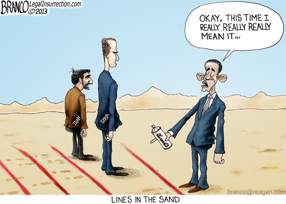
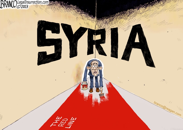
STEVE HOLLAND, REUTERS: Have you made up your mind whether to take action against Syria whether or not you have a congressional resolution approved? Is a strike needed in order to preserve your credibility for when you set these sort of red lines? And were you able to enlist the support of the prime minister here for support in Syria? PRESIDENT OBAMA: Let me unpack the question. First of all, I didn't set a red line. The world set a red line. The world set a red line when governments representing 98 percent of the world's population said the use of chemical weapons are abhorrent and passed a treaty forbidding their use even when countries are engaged in war. Congress set a red line when it ratified that treaty. Congress set a red line when it indicated that in a piece of legislation titled the Syria Accountability Act that some of the horrendous thing that are happening on the ground there need to be answered for. And so, when I said, in a press conference, that my calculus about what's happening in Syria would be altered by the use of chemical weapons, which the overwhelming consensus of humanity says is wrong, that wasn't something I just kind of made up. I didn't pluck it out of thin air. There was a reason for it. That's point number one. Point number two, my credibility is not on the line. The international community's credibility is on the line. And America and Congress' credibility is on the line because we give lip service to the notion that these international norms are important.People are contrasting it with this August 2012 statement: This is too important for gamesmanship:
Rand Paul: Congress "getting too involved on how we execute war."...
Mideast Media Sampler 09/03/2013 - Identifyng a Scapegoat for the President's Inaction...
The conventional wisdom is answering the wrong question....


Indications are that the Obama administration's response will be to drop a few bombs, break some stuff, and maybe kill a few bystanders. That comes nowhere near being a just punishment for the crimes alleged. Nor does it seem likely to prove an effective deterrent. Other dictators will see that they can use chemical weapons without endangering their survival (in both senses of the word). Assad will have tested the resolve of "the world" and found it wanting: Even after using chemical weapons, he will remain in power, with no reason to expect any external response to any further atrocity that doesn't involve chemical weapons.
Donations tax deductible
to the full extent allowed by law.
Founder
Sr. Contrib Editor
Contrib Editor
Higher Ed
Author
Author
Author
Author
Weekend Editor
Author
Editor Emerita

