
Iran deal done – now must come the reckoning
on September 02, 2015
45 Comments
The Iran nuclear deal, which is so bad in so many ways explained here so many times, is a done deal.
Democrats now have enough votes in the Senate to prevent an override of an Obama veto of a resolution of disapproval, if it even gets to a vote given Democrats are close to the votes needed to filibuster.
Partial blame belongs to Republicans in the Senate for agreeing to a procedure that required passage of a resolution of disapproval by a supermajority, rather than approval by a supermajority, or even a majority. But at least Republicans opposed the deal, which means that majorities in each house of Congress are against it.
Whatever procedural mistakes Republicans made are dwarfed by the substantive embrace of the deal by most Democrats in Congress. That despite the fact that the deal is hugely unpopular overall, and is at best a split decision even among Democrats not in Congress.
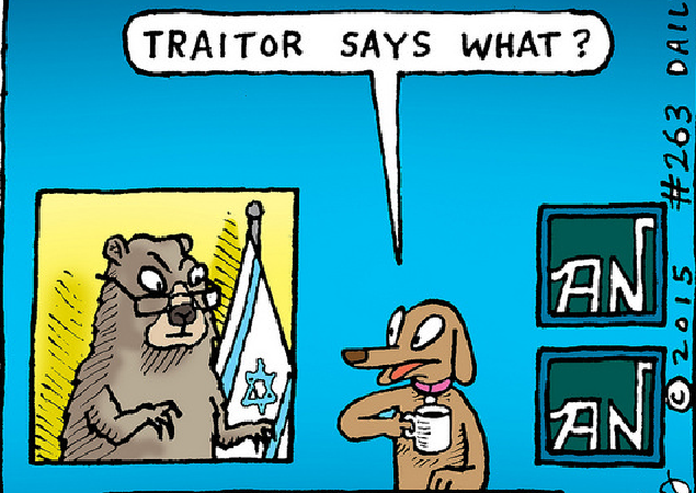
It is not an exaggeration to say that loyalty to Obama was the overriding factor. Democrats in Congress were the main targets of Obama's demagoguery -- be with Obama or be for war; be with Obama or be for the monied lobbyists. The message was clear: Be with Obama or be a traitor.
So the deal will not fail. To say that it "passes" is inaccurate.
There will be calls once the votes are taken to heal. To make Israel, once again, a matter of bipartisan consensus.


![[Ali Dawabsheh and Hadas Fogel]](https://legalinsurrection.com/wp-content/uploads/2015/07/Ali-Dawabsheh-Hadas-Fogel-e1438608778800.png)