Major Earthquake Rocks Alaska’s Coast; Region Placed Under a Tsunami Advisory
The earthquake occurred near Sand Point, approximately 600 miles southwest of Anchorage. Reports are still coming in.
A major earthquake rocked a region approximately 600 miles southwest of Anchorage, Alaska, this afternoon, prompting a tsunami warning from the National Weather Service. Initially, a tsunami had been reported as confirmed.
A tsunami warning has been issued for south Alaska and the Alaska Peninsula after a massive 7.3-magnitude earthquake, according to the National Weather Service.
The NWS said it is still evaluating the tsunami danger of other North American coastlines, including Washington state.
“We are still examining what exactly this means for Washington state coastlines,” Washington’s Emergency Management Division announced. “We are in contact with the National Tsunami Warning Center.”
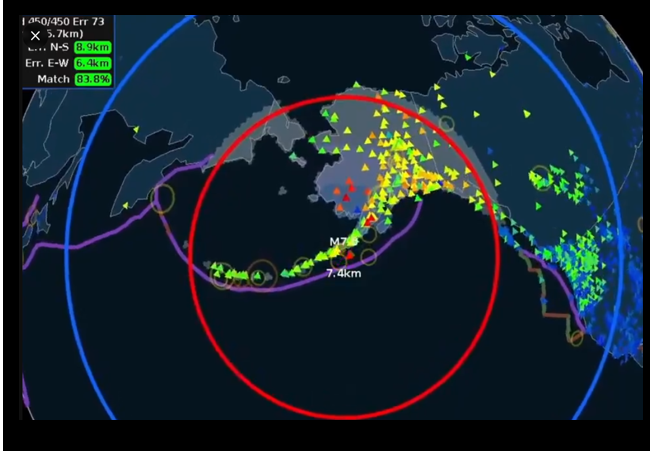
The large earthquake was recorded about 54 miles south of Sand Point, Alaska, and at a depth of nearly 12.5 miles underground.
UPDATE: A tsunami has been confirmed and some impacts are expected. Sirens are now sounding. SEEK HIGHER GROUND NOW. pic.twitter.com/W6uiCPQ0YU
— James Pettus (@PettusWX) July 16, 2025
Sand Point is located on the remote Popof Island, where the Alaska Peninsula meets the Aleutian Islands chain.
#BREAKING : Following the M7.2 earthquake, tsunami waves are expected to reach parts of Alaska shortly.
Estimated Arrival Times (AKDT):
• Sand Point: 1:30 PM
• Cold Bay: 2:25 PM
• Kodiak: 2:40 PM#Alaska #Earthquake #Tsunami #SandPoint #Breaking #DisasterAlert #TsunamiAlert… pic.twitter.com/uEDEnKTmmo— upuknews (@upuknews1) July 16, 2025
Fortunately, the predicted tsunami waves don’t appear to be significant, and the area is now under a tsunami advisory.
NEW: The warning has been downgraded to a TSUNAMI ADVISORY. It's likely that peak tsunami heights will be about 4 feet or less.
Still – wave motions could cause damage at some marinas and docks. pic.twitter.com/1sebHUySRg
— Matthew Cappucci (@MatthewCappucci) July 16, 2025
Today’s shaker occurred along in an area that is dominated by the Aleutian Megathrust (the subduction zone between the North American and Pacific Plates), which is responsible for most of the large earthquakes in the Alaska Peninsula.
The preliminary focal mechanism solution indicates rupture occurred on a fault dipping either shallowly to the northwest, or steeply to the southeast. The location, mechanism and depth – and the large size of the event – are all consistent with slip occurring on the subduction zone interface between the two plates. At the location of this event, the Pacific plate converges with North America to the northwest at a rate of about 70 mm/yr, subducting at the Alaska-Aleutians trench 125 km to the southeast of the earthquake.
While commonly plotted as points on maps, earthquakes of this size are more appropriately described as slip over a larger fault area. Thrust faulting events of the size of the July 16, 2023 earthquake are typically about 55×30 km (length x width).
Large earthquakes are common in the Alaska-Aleutian subduction zone. Since 1900, nine other earthquakes M7 and larger have occurred within 250 km of the July 16, 2023 event. The largest of these was a M8.6 earthquake on April 01, 1946, which occurred about 150km to the west-southwest of the July 16, 2023 earthquake. The 1946 M8.6 generated a tsunami that devasted the lighthouse on Unimak Island and swept away its five occupants. Tsunami damage also occurred at Dutch Harbor and Ikatan Island in the Aleutian Islands, on the west coasts of North and South America, and in Hawaii. At Hilo, Hawaii, the tsunami took 159 lives and caused one death in California. The Alaska-Aleutian Trench also hosted the second largest earthquake recorded by modern seismic instrumentation, the M9.2 March 27 1964 earthquake in the Prince William Sound region of Alaska.
This post will be updated as additional reports come in.
Donations tax deductible
to the full extent allowed by law.


Comments
Tsunami’s are cool unless you are the target of one,
I wouldn’t lose any sleep if one took out Gate’s private island.
What’s the definition of a tsunami? I’ll admit my ignorance but I didn’t know a 4 foot wave could be called a tsunami.
A tsunami is a tidal wave, caused by the sudden displacement of a lot of water by something like an earthquake, a landslide, a meteorite, etc.
A “tidal wave” is a separate phenomenon. A tsunami, as you said, is caused by earthquakes and other high-energy events that displace a large amount of water. Although a colloquialism for a tsunami, the use of “tidal wave” for “tsunami” is discouraged.
Wikipedia describes it well:
https://en.wikipedia.org/wiki/Tsunami
To expand, one thing that makes tsunamis special is the waves waves have extraordinarily long wavelengths, often more than 100 kilometers in deep ocean, and their periods (the time between wave crests) can range from 5 minutes to over an hour.
To expand, one thing that makes tsunamis special is the waves waves have extraordinarily long wavelengths, often more than 100 kilometers in deep ocean, and their periods (the time between wave crests) can range from 5 minutes to over an hour..
The word tsunami comes from the Japanese words “tsu” (harbor) and “nami” (wave).
The Alaskan Earthquake back in 1964 caused waterways all the way down to Louisiana to rise and fall several feet. My dad and brothers were camping in the Atchafalaya Basin when the bayou they were on suddenly rose and fell several times. They didn’t know what caused it until they returned to Lafayette after the campout.